
Columbia River Gorge and Mt. Hood
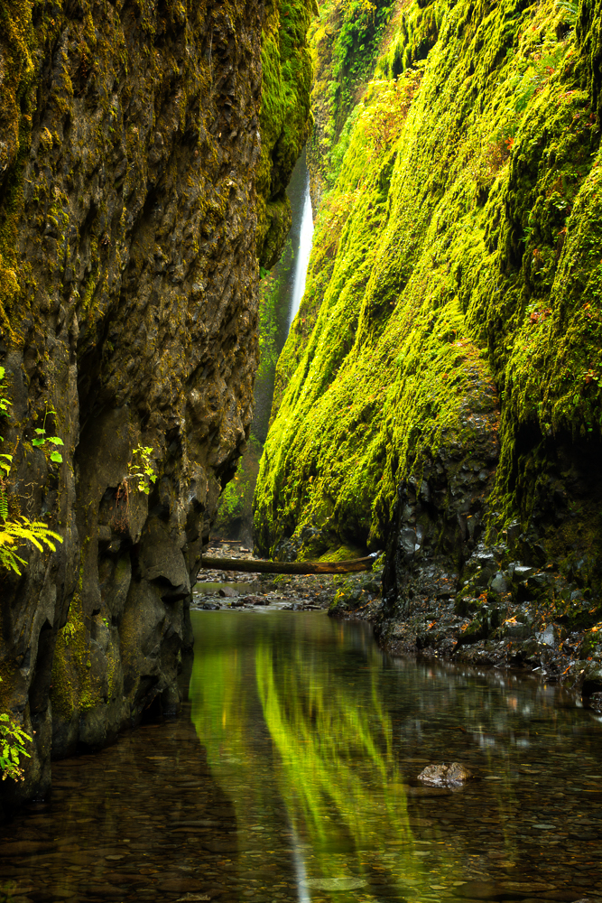
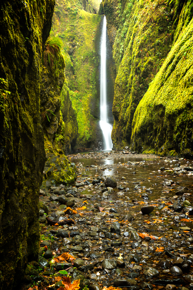
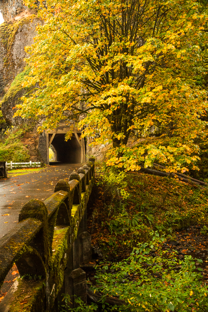
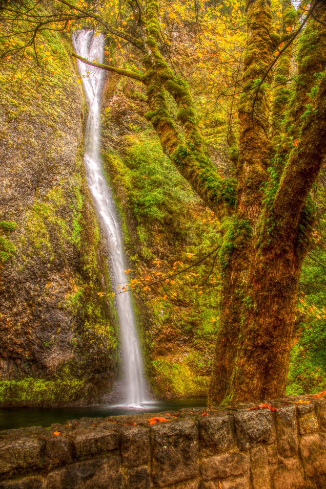
On Day 3 of our Oregon vacation we once again we arose to light drizzle with the promise of improvement later in the day. Over breakfast, we decided to attempt the 0.3 mile scramble into Oneonta Gorge. This one was on my bucket list, but there were some unknowns. There is a big log jam a short way into the gorge and I was not sure the difficulty of navigating it. There is also a spot where the gorge narrows and the water can get quite high. At periods of high water, this section requires swimming. We planned on getting wet, so wore sneakers and light pants that we wouldn’t mind getting wet. Keep in mind that this is Oregon in October and we had no idea how cold the water might be. We pulled into the parking area and followed the narrow trail down one side of the bridge crossing the gorge stream and headed out. A short distance up stream we encountered the log jam. We found that even though the logs were wet, they were not slippery due to the number of people frequenting this spot. We had to climb over, under, and through portions of the jam, but it was not difficult; just time consuming. Post log jam the walk was beautiful as the gorge walls rose up over our heads and the way became increasingly narrow. Within site of Lower Oneonta Falls and the head of the gorge, we encountered deep water. It reached my waist, but we were quickly through and once again on bare stones on the gorge floor. Luckily the water was not ice cold and we were quick to recover once out. There were only two others in the gorge really working the place with their cameras. Tammy helped me out with keeping my camera dry as there was a pretty steady drizzle coming on. I took photos for 20 minutes or so, before we decided to head back. Before hitting the road, we also stopped for a quick shoot at Horsetail Falls close by.
Be advised… the video is long, but browse through it, it’s pretty cool….
With the sky still overcast, we headed up the Columbia River to the town of Hood River for lunch and brews at Full Sail Brewing Company. Awesome beer and great food! The sky was continuously improving with sun, patches of blue sky, and plenty of white, puffy clouds. The plan for the afternoon was to drive scenic route 35 to route 26 around Mt. Hood. Just outside of Hood River we began to pass fruit farms and orchards the likes of which I have never seen. There was every variety of apple and pear tree that you could imagine as well as high bush blueberry and grapes. Local farm stands were in abundance and we stopped at one to grab a couple of local pears and apples. As we continued into the back county the elevation continued to increase drastically. As we crept closer to Mt. Hood (of which we had yet to catch a glimpse) the clouds rolled in and light rain returned. We were to find that this was common. The Cascade range forces the moist Pacific air to drop its moisture on the West side of the mountain leaving the East side much drier. We stopped by Trillium Lake on the South West side of Mt. Hood, scouting for potential early morning locations to shoot. We also stopped by Sahale Falls. This one is easy to access by vehicle. As we had increased elevation significantly, it was pretty cold here. Continuing on, we stopped at the village of Government Camp for a gas up as stations were few and far between on this stretch of road. When we reached Zig Zag we hopped onto the LoLo Pass road (closed in winter) hoping for a scenic route back to Hood River. This road was paved for a long way and followed power lines up and over the pass. It eventually turned to a one lane dirt road with no junction signs. After miles of driving we finally ended up on paved road heading toward Lost Lake (portion of the drive here). I was hoping to scout here for morning shots as well, but I guess they named it Lost Lake for a reason. We found the access gate to the Lost Lake Resort, but all was gated. Driving around some of the roads close by, we never did get a view of the lake. As the afternoon wore on, we headed back to Hood River. On the way we turned off 35 and drove to Panorama Point. We finally got our first view of Mt. Hood.

After a quick stop we headed for Big Horse Brew Pub. We grabbed a quick beer there, enjoying the unique setting on a side hill overlooking the town, then headed back ‘home’ to Cascade Locks. We hadn’t had any dinner yet, so back at Cascade Locks we located Thunder Island Brewing and enjoyed another beer and some so-so nachos. We had a bit of a time finding the place as it was after dark, and what eventually turned out to be the brewery looked like a town garage. Overhead doors were open with a small pay-as-you-go step up bar area. After this stop, we were ready to hit the hay. Short hike, road trip, and three breweries…. Busy day!